County Louth Ireland · Co. Louth · Dunleer Save · Share
POSTED FROM
DUNLEER
CO. LOUTH · IE

Dunleer
Dún Léire

The Ireland's Ancient East
STOP 05 / 05
Dún Léire · Co. Louth

A working mid-Louth town with three motorway junctions of its own and a 1252 charter behind it.

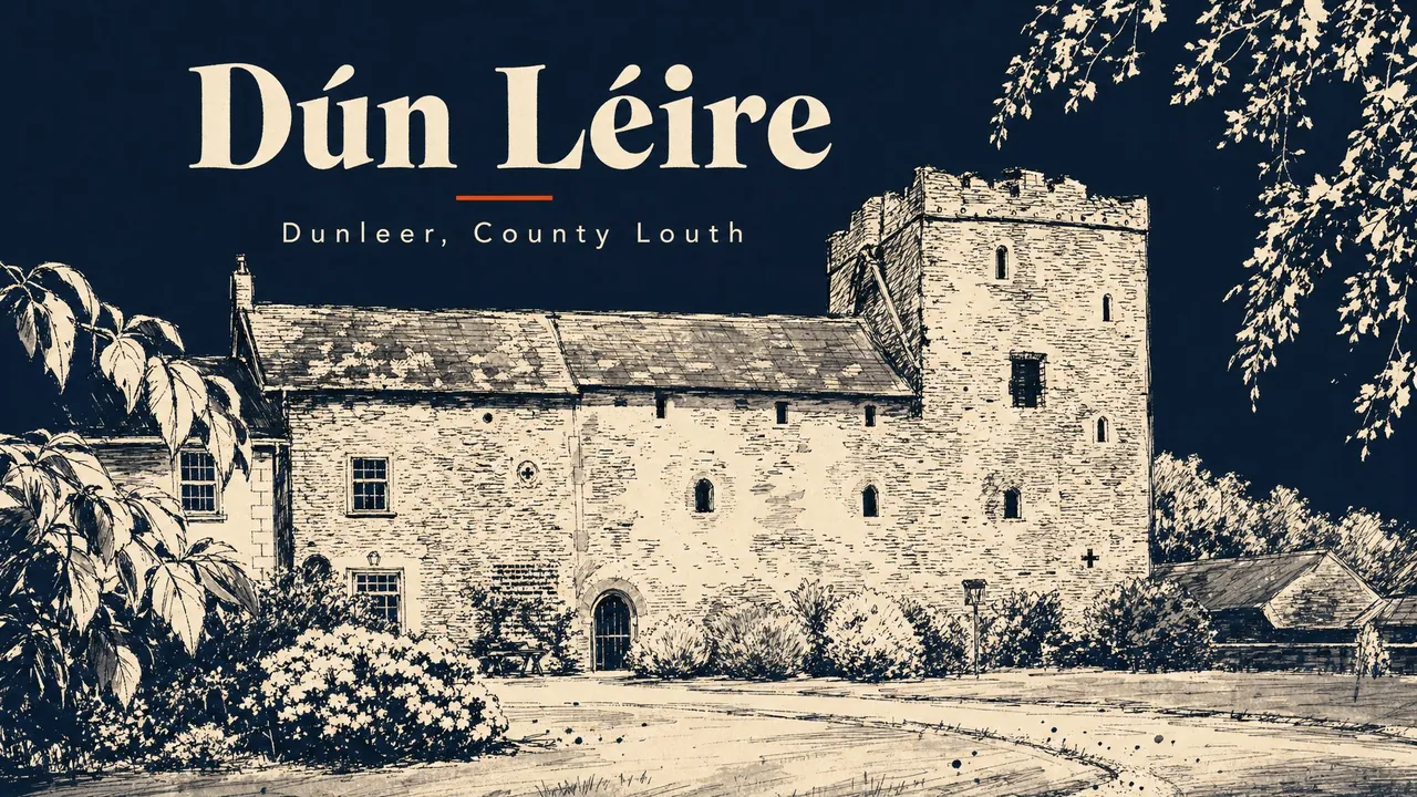
Dunleer is a working town of around 2,100 people on the M1, exactly halfway between Dundalk and Drogheda, served by three motorway junctions (12, 13 and 14). The traffic that used to grind through the centre on the old N1 now goes around it on the M1. The result is the calmest the centre has been since the 19th century. A working high street, three pubs, a parish church with a webcam, and a manufacturing estate that has been turning out domestic appliances since the late 1930s.

The town is older as a chartered borough than most of the county. A market charter in 1252; an enhanced charter from Charles II in 1671; a Royal Charter in 1678 establishing Dunleer as a municipal corporation — the very last borough to be set up by charter in Ireland. The corporation lasted in working form until 1811. Dunleer also had a railway station from 1851 to 1984 — closed by Córas Iompair Éireann long after most rural stations had gone. The footprint of the station is still there. The locals would like it back; Iarnród Éireann last said no in 2021.

Don't come for tourism. Come for a working Louth town doing what working Louth towns do — a coffee on Main Street, a pint in Shearman's or Dorian's, a look at St Brigid's spire from the church grounds, and the Long Walk along the millrace at the back of the town. Drive five minutes south to Monasterboice for the high crosses, ten minutes north to Castlebellingham for the castle hotel, fifteen minutes west to Ardee for the medieval tower-houses. Dunleer is not the destination. It is a sensible base in the middle of the county. The bed is cheaper than Drogheda and the M1 is at the door.

Population
~2,143 (2022)
Pubs
4and counting
Walk score
Sarsfield Cross to St Brigid's in fifteen minutes
Founded
Market charter 1252; Royal Charter 1678 — last borough established in Ireland
Coords
53.8333° N, 6.4000° W
01 / 09

At a glance.

Three things every local will eventually mention. Read these and you've already understood more than most day-trippers do.

02 / 09

The pubs.

None of these are themed Irish pubs, because they don't need to be. A few that earn the trip:

Dorian's Bar

Town-centre local
Pub at Sarsfield's Cross

On Sarsfield's Cross at the heart of the town. Listed in the Yelp directory as the regulars' bar — small, traditional, the kind of pub where everyone knows the next round. Music sessions when the room calls for them.

Shearman's Bar

Local, food at lunch
Pub on Main Street

Tripadvisor-listed, food and drink. The mid-day pub for a sit-down sandwich and a pint when you are passing through. The lounge is the calmest room in the centre on a wet Tuesday.

The Mill Race Inn

Community pub
Pub on the millrace, Dessie Connor

On the millrace at the edge of the town centre, run by Dessie Connor for a long time. Hosts the Mid-Louth Camera Club among others. Functions, music, a longer bar trade than the village pubs. Worth a stop if Shearman's or Dorian's does not suit.

The Valley Inn at Mullary

Country pub, dining
Pub & restaurant 4 km outside town

Out of the centre at Mullary, four kilometres from Dunleer Cross — proper sit-down restaurant and bar, breakfast / lunch / evening menu. The country option for a lunch on a country drive. Drive there; it is not a walk.

03 / 09

Where to eat.

PlaceTypeLocal note
The Valley Inn Pub & restaurant, Mullary €€ Four kilometres outside Dunleer at Mullary. The proper sit-down option in the area — breakfast, lunch, evening menu. Country-pub kitchen, full plates, the Sunday lunch fills the room. Book at weekends.
Shearman's Bar lunches Pub kitchen, Main Street Useful day-time stop on Main Street — soup-and-sandwich, a few hot plates. Reliable rather than ambitious.
Mill Race Inn pub food Pub kitchen on the millrace Pub food at the Mill Race — daily specials, the kind of plate that does the job after a long M1 drive. Useful as a lunch when you are passing.
A note on dinner Out of town Dunleer is not a fine-dining town. For a serious night out, locals drive ten minutes south to Drogheda (Eastern Seaboard) or fifteen minutes north to Dundalk (Rosso, the Spotted Dog) or five minutes east to Castlebellingham for the Bellingham Castle dining room. Plan that into the trip.
04 / 09

Where to sleep.

PlaceTypeLocal note
B&Bs and short-term lets Around the town and the M1 junctions Dunleer is a sensible base for the area — cheaper than Drogheda or Dundalk, three motorway junctions on the doorstep, twenty minutes to Newgrange or to the Cooleys. Search by Dunleer. Most stays here are practical rather than scenic.
Bellingham Castle Hotel Hotel ten minutes north If you want a hotel rather than a let, Bellingham Castle in Castlebellingham is the obvious move — 17th-century country house, formal dining, walking distance to the village green. Drive ten minutes back into Dunleer for the M1 in the morning.
Drogheda hotels Hotels ten minutes south For chain hotels, Drogheda has the d Hotel and the Westcourt. Ten minutes south of Dunleer on the M1. Useful if you are doing the Boyne Valley sites and need volume.
05 / 09

Stories & lore.

The reason to come back. The things every local will eventually tell you about, usually after the second pint.

1678, end of an era

The last borough

Dunleer received a market charter from Henry III in 1252, an enhanced charter from Charles II in 1671 confirming the right to hold markets and fairs, and a Royal Charter in 1678 establishing it as a municipal corporation with a mayor and burgesses. It was the very last borough to be founded in Ireland by Royal Charter. The corporation continued to meet, on paper at least, until 1811, when the Act of Union had already removed most boroughs from the map. The street pattern Dunleer carries — a single broad main street with side lanes running off it — is the medieval and 17th-century corporation grid almost unaltered. The Tholsel that once stood at the centre is gone, but the layout remains.

The major stop between Dundalk and Drogheda

The railway, 1851 to 1984

Dunleer station opened on the Dublin and Belfast Junction Railway in 1851 and was, at its peak, the major intermediate stop between Dundalk and Drogheda. Goods services ended on 2 December 1974. Passenger services lasted another decade, until the station closed altogether on 26 November 1984 — long after most rural stations on the line had gone. The footprint is still there at the back of the town. Local lobbying has called for the station to be reopened on the Dublin commuter belt; a 2009 plan flagged it as a possibility, but the National Transport Authority confirmed in 2021 that there were no plans. The town is on the line; the trains do not stop. They go past.

A factory town since the 1930s

Domestic appliance manufacturing

Dunleer has been a centre of domestic appliance manufacturing since the late 1930s. The site of a former flax mill at Rosevale on the Barn Road became, in the 20th century, the home of the Glen Dimplex operation — heaters, irons, electric appliances under various brand names. At its peak the plant employed many hundreds. In January 2025 Glen Dimplex announced consultation on around 70 redundancies and the wind-down of manufacturing in Dunleer; the site is being repurposed. The town is also home to Glebe Brethan farmhouse cheese and Lannleire Honey. Working manufacturing, not heritage manufacturing.

1859 stonework

St Brigid's spire

St Brigid's Catholic Church on Old Chapel Lane sits on the site of an 1780s thatched chapel and a small priest's cabin. The present building is recorded from 1802. The three-stage tower and spire were added in 1859, the major Victorian refurbishment in 1884. The church was renovated again in 2000–01. The spire is the highest point in the town centre and the parish webcam — installed for emigrants and the housebound — has become one of the more-watched parish cameras in Ireland. The church is on a busy pedestrian thoroughfare between the main street and the housing estates to the west; on a Sunday it is the busiest corner of Dunleer.

06 / 09

Things to do outside.

Wear waterproofs. Bring a sandwich. Tell someone where you're going if it's the mountain.

The Long Walk along the millrace Dunleer's main local walk — a path along the old millrace at the back of the town. Flat, mostly paved, dog-walkers and prams, herons in the water if the light is right. Useful as an evening leg-stretcher when you are staying in the area. Pick it up at the Mill Race Inn end.
3 km returndistance
1 hourtime
St Brigid's and the town centre Short, deliberate. From Sarsfield's Cross down Main Street, up Old Chapel Lane to St Brigid's church, around the parish grounds with the tower and spire above you, back via the side streets reading the older shopfronts. The medieval-corporation grid is what you are walking.
1 km loopdistance
30 mintime
Monasterboice from Dunleer Not a walk from town, but the obvious onward stop. Monasterboice — Muiredach's Cross is one of the finest Irish high crosses, the round tower is the tallest in the county — is ten minutes south by car off the R132. OPW site, no admission. Combine with Mellifont Abbey ten minutes further south for a half-day Boyne Valley round.
8 km drivedistance
Half a daytime
07 / 09

When to go.

There is no bad time. There are different times.

Spring
Mar–May

The Long Walk is at its best in spring — millrace running full, hawthorn coming out. The town is quiet. M1 traffic is the only crowd you will meet.

◉ Go
Summer
Jun–Aug

The town keeps its working pace — Dunleer is not a tourist place and August is much like any other month. Useful as an affordable base for the Boyne Valley if Drogheda is full.

◉ Go
Autumn
Sep–Oct

October on the millrace is the local walking season. The Valley Inn does its Sunday lunch trade. Pubs are at their most local on a Tuesday evening.

◉ Go
Winter
Nov–Feb

Short days. The pubs and the Valley Inn stay open, the Long Walk is a wet boots affair, and the parish webcam runs the funerals from the spire of St Brigid's. A practical base rather than a destination.

◐ Mind yourself
08 / 09

What to skip.

Honestly? Don't bother.

If a local was sitting beside you, this is the bit where they'd lean in.

×
Looking for a Dunleer greyhound stadium

There isn't one. Locals are sometimes asked about it; there is no greyhound stadium in Dunleer. The greyhound stadium in Co. Louth is at Dundalk Stadium, twenty minutes north — and it is also the only all-weather horse-racing track in Ireland. If you want greyhounds, drive there.

×
Driving through on the M1 without stopping

Most people do this. The town has three motorway junctions and the centre is two minutes off any of them. Stop for a coffee, walk the Long Walk for half an hour, look at St Brigid's spire, and you are back on the road in forty minutes the better for it.

×
Expecting a tourist office or visitor centre

Dunleer is a working town. The information you need is on the parish website and the Visit Louth pages. No turnstile, no leaflet rack. The town does not pretend otherwise.

+

Getting there.

By car

Dublin to Dunleer is 50 minutes on the M1 to junction 14 (Dunleer / Ardee). The town has three motorway junctions — 12 (south), 13 (centre) and 14 (north). Dundalk is 15 minutes north, Drogheda 15 minutes south, Ardee 10 minutes west via the N33 / N2.

By bus

Bus Éireann route 100 / 100X (Dublin–Derry) stops at Dunleer on the N2 corridor several times daily — about 1 hour from Dublin Busáras. Local Link runs additional services to Drogheda and Dundalk on weekdays.

By train

No train. The Dunleer station closed in 1984 and Iarnród Éireann has no plans to reopen it. The Dublin–Belfast Enterprise passes through without stopping. Nearest stations are Drogheda (15 minutes south) or Dundalk (15 minutes north).

By air

Dublin Airport (DUB) is 40 minutes by car straight up the M1 — Dunleer is one of the closer Louth towns to Dublin Airport. Belfast International (BFS) is 1h 15m. Dublin is the obvious arrival.